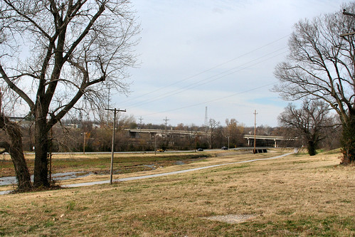
The north end of Joplin’s Main Street is quiet today. The Joplin Union Depot sits abandoned, visited only by aspiring graffiti artists and the historically curious, hoping to catch a glimpse of Joplin’s glory days in the weathered, intricate designs of architect Louis Curtiss. With the arrival of winter, Landreth Park is empty, save for the urban wildlife that call it home. Joplin Creek, the one constant in the ever changing landscape over the last one hundred years, remains. If only its silent waters could tell stories of the contentious rivalry between East and West Joplin, the mining operations that clouded its waters, and of the numerous families who lived in dire poverty along its banks in what was once known as the “Kansas City Bottoms.”
The name Kansas City Bottoms, according to one source, was derived from the Kansas City Southern Railway. Dolph Shaner, however, argued that the name “Kansas City Bottoms” came about because, “Kansas City and Independence, Missouri, capitalists, headed by John H. Taylor, purchased 120 acres of land extending from Fourth Street north three-fourths of a mile along Joplin Creek. The land being owned by Kansas City men, the valley at that point was dubbed ‘Kansas City Bottoms.’”
Attorney Clark Claycroft was one of Joplin’s earliest residents. Toward the end of his life he recalled that, “[John B.] Sergeant made the first big strike of lead ore in Kansas City bottoms, near the mouth of what now is known as Sunshine Hollow.” Veteran well driller Perry Crossman provided more detail, stating in an interview, “Late in the fall of 1871, I made a contract with John H. Taylor of the Joplin Mining and Smelting Company to drill a hole in a pump shaft in the Kansas City Bottoms. Charles Glover, now with the Joplin Globe, drew up the contract for Taylor and myself. That was the first hole ever put down to make a test for ore, and it ended in limestone.”
The area quickly became a magnet for men who sought to make a fortune in the lead and zinc industry. The Joplin Creek valley became inundated with hundreds of would-be miners who lived in tents, constructed crude shanties, or slept out in the open to stay close to their prospective strike. Joplin resident Dolph Shaner remarked that where Landreth Park is now located, “there once existed many, many mine dumps; all are now filled, leveled, and covered with grass.”
As mining operations left the Joplin Creek valley and spread out across the region in search of rich lead and zinc deposits, one might think that story of the Bottoms was over. It was not. As the population grew, two rival entities, East and West Joplin, sprang into existence. The bottoms connected the main streets of East and West Joplin and soon turned into a battleground between young men who fought on behalf of their town’s honor. We will leave it to the reader to pick up a copy of Shaner’s book to read in detail about the fistfights and rivalries that took place.
Stay tuned for Part II of the Kansas City Bottoms…


I remember looking at some Sanborn maps of Joplin and that there was one are labelled “Negro Cabins.” Is this the area?
Without knowing which Sanborn maps you were looking at, we can’t say for sure if it was or not, unfortunately. A quick glance at a few different years didn’t yield any such findings, though, it seems there may have been more than one section of Joplin where the African-American community may have been located.